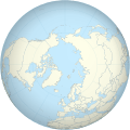
Imådje:Worldmap northern.svg
Apparence

Taille de cet aperçu PNG pour ce fichier SVG : 553 × 553 picsels. Ôtès fintés: 240 × 240 picsels | 480 × 480 picsels | 768 × 768 picsels | 1 024 × 1 024 picsels | 2 048 × 2 048 picsels.
Fitchî d’ oridjinne (Fitchî SVG, finté di 553 × 553 picsels, grandeu: 589 Ko)
Istwere do fitchî
Clitchîz so ene date ey ene eure po vey kimint ki l’ fitchî esteut adon.
| Date/Eure | Imådjete | Grandeur | Uzeu | Comintaire | |
|---|---|---|---|---|---|
| asteure | 1 may 2013 à 12:34 |  | 553 × 553 (589 Ko) | Gringer | updated script -- proper group ordering |
| 29 avri 2013 à 01:03 |  | 552 × 552 (465 Ko) | Gringer | Updated perlshaper script | |
| 3 setimbe 2010 à 10:31 |  | 550 × 550 (563 Ko) | Gringer | Updated using [http://www.naturalearthdata.com Natural Earth Data]. | |
| 13 fevrî 2009 à 01:17 |  | 181 × 181 (308 Ko) | Gringer | increase in ocean size to make border sit mostly outside land | |
| 13 fevrî 2009 à 01:10 |  | 180 × 180 (308 Ko) | Gringer | {{Information |Description={{en|1=A polar projection of the northern hemisphere from Image:Worldmap_wdb_combined.svg. Created from [http://www.evl.uic.edu/pape/data/WDB/ CIA World Databank data] using an updated version of my [http://user.interface.o |
Eployaedjes do fitchî
I n’ a nole pådje k’ eploye ci fitchî ci.
Eployaedje tot avå do fitchî
Les ôtes shuvants wikis eployèt c’ fitchî ci :
- Eployaedje so en.wikipedia.org
- Eployaedje so pl.wikipedia.org
- Eployaedje so pl.wikinews.org
- Eployaedje so sl.wikipedia.org

